Uncategorized

Report from the BRT Workshop

The BRT Workshop went well. Our table seemed generally supportive of the various improvements proposed, and we specifically focused on Queens Boulevard for BRT treatment.

Some of the other participants were interested in my Kew Gardens transfer proposal. I was able to chat with Queens Transportation Commissioner McCarthy, and she told me that the bus stop was closed because three people had died there (presumably being hit by cars).

I acknowledged that safety should be our primary concern, but suggested that if the will is there to reserve the curbside lane for buses with physical barricades, that would eliminate a lot of the potential safety hazards. She seemed interested, but with the DOT you can never tell.

Better Buses, Commentary, Queens

From Bus to Subway in Kew Gardens

On Tuesday night, June 2, I will be attending the first Queens Bus Rapid Transit workshop in Jackson Heights. Here’s a proposal I will be bringing with me.

“Bus rapid transit” is no more than the sum of its parts, and many elements of it can be used by themselves to produce a significant improvement in transportation quality. One such element is enclosed stations with pre-boarding fare control. The Union Turnpike station is ideally suited to this, because most of the facilities already exist. The subway station has the usual fare control system with turnstiles and high-wheel gates. It also has an enclosed connection to a roadway.

Just north of Kew Gardens, an eight-lane highway passes under Queens Boulevard. The middle four lanes are the Jackie Robinson Parkway headed for East New York. The lanes on either side carry through traffic on Union Turnpike. On either side of those lanes are two more with traffic turning onto Queens Boulevard.

kewunion1

The Union Turnpike-Kew Gardens subway station is a major station in central Queens. It’s one of the several points where subway riders from Manhattan and western Queens can transfer to the bus network that is the only transit for much of eastern Queens. The Q46 goes east on Union Turnpike from here, the Q74 goes north on Main Street, the Q10 goes south to Kennedy Airport and the Q37 south to Ozone Park.

Bus routes that feed the Union Turnpike station

The subway-bus transfers are often slow and clumsy because the buses take circuitous routes to turn around. For example, the Q46 terminates on the north side of Queens Boulevard, then has to go two blocks west, make a U-turn, go back east and then take a big left onto Union Turnpike.

Even to get to the bus stops, subway passengers have to climb three flights of stairs. For some of the more popular buses, the stairs are not wide enough to handle peak demand, and there is conflict between passengers going down and passengers going up.

Meanwhile, people who live in Glendale don’t have any subway or train service, and limited bus service to connect them to the subway. Getting from Kew Gardens Hills to Kew Gardens requires a long walk, a long ride or two bus transfers. These are two of the Underserved Areas identified in the NYC DOT Phase II report (PDF).

Improving these transfers could trim five to ten minutes off of each bus rider’s commute, which would be a huge boost to transit in central Queens. Here’s one way to do it: right now the buses all go up to Queens Boulevard, turn and stop at the subway stairs. Passengers bound for the subway go up to go down. But if the buses continued on through the tunnel they’d be at the mezzanine level of the subway station.

kewblocks090409a

How would the passengers get into the station? Well in fact, that mezzanine used to be open to Union Turnpike for many years, with just a guardrail separating people from cars. It was not very pleasant walking next to the noisy, smelly, speeding traffic. In a recent renovation the MTA installed glass bricks that make the station much nicer; you can see the road through them.

kewblocks090409b1

Now imagine that the glass bricks, fence and guardrail are gone, and there are bus stops there. You’re riding in on the Q46, and instead of going up to Queens Boulevard it goes through the tunnel and stops. You get off, go down one flight of stairs, and get on your train. If you’re coming from the train, you go up one flight of stairs and get on your bus. No turnstiles, no dipping Metrocards, no waiting for everyone else to dip their Metrocard, and much less crowding on narrow stairs.

To do this, the MTA would have to reconfigure the routes, which could allow for better connections between neighborhoods. The Q74 and Q46 could turn around at Park Lane, but they could also continue on to Metropolitan Avenue, Woodhaven Boulevard or Myrtle Avenue in Glendale. The Q10 and Q37 could turn at the 141st Street loop, but they could continue along the Grand Central Parkway service road to Main Street, Parsons Boulevard, 164th Street or even Utopia Parkway, connecting with the Q25, Q34, Q44 or Q65.

kew-after1

The roadway under Queens Boulevard would also have to be reconfigured. The approach to the bus stops would have to be restricted to buses only, to prevent private vehicles from beating the fare by dropping off passengers inside the fare control zone. This would also prevent through traffic from being blocked by stopped buses. I don’t know how much space there is under there for bus stops, so it may require devoting all four lanes of what’s currently considered Union Turnpike to buses and requiring cars to use the four middle lanes. However, it might only require one lane in each direction, in which case the barriers could be moved so that all car traffic has three lanes available to it.

Uncategorized

San Juan, city of cars

I couldn’t write about transportation in San Juan without mentioning the city’s legendary car congestion. The historic, dense, walled city of Old San Juan is jammed with cars and has apparently no pedestrian-only streets.

A lot has already been said about this. It turns out that Streetsblog editor Aaron Naparstek found Old San Juan to be very car-dependent in 2005, and in 2008 Deputy Editor Brad Aaron found the same thing. I just have a few things to add.

Several sources mentioned that the city has one of the highest per-capita rates of car ownership in the world; this page gives the most complete statistics I could find – 617 per thousand people, which is apparently still below San Francisco.

Old San Juan was so congested that almost every street had a line of cars creeping along it. Driving was almost as slow as walking. I was surprised that people would put up with something so inconvenient. By comparison, the Colonial Zone of Santo Domingo is very comfortable for pedestrians, with a mile-long pedestrian-only street.

The high amount of car use has clearly been encouraged by several large multi-level parking garages that line the southern coast of the small island that holds Old San Juan and the Puerta de Tierra district that houses many of the territory’s administrative buildings. There are similar structures all over the city. The multiple large expressways running through the dense downtown areas can’t help anything, either. They cut the neighborhoods of the Santurce district off from each other.

Old San Juan may be compact, but it still takes a while to get around, in part because so much of the street space is devoted to cars. This leaves just a narrow strip of sidewalk on each side, which we usually found to be crowded with other tourists. All of the buses stop at the main bus station outside the old main gate, and the only transit that goes further into the city are the free “trolleys.”

No, these are not the actual trolleys that used to run through San Juan, but the transvestite buses that are sadly so typical in historical districts. They kept the uncomfortable wooden seats, of course, but the ride is as bumpy as a bus. What’s worst is that whatever agency runs them seems uninterested in actually doing a good job. We waited for at least fifteen minutes before one showed up, and it was full. Fortunately, there was another one bunched behind it, but that one had only enough seats for us, meaning that we were crowded together with other tourists for the interminable stop-and-go through the narrow streets.

Uncategorized

The counterflow bus lanes of San Juan

Proponents of “bus rapid transit” (BRT) like to portray it as a package, but the whole isn’t necessarily greater than the sum of the parts. You can improve performance with just one or two of the “BRT” components, as I learned in San Juan.

Dedicated busways are one such component, and one way to create them is with counterflow lanes. I had used facilities like this in Paris, and they definitely sped up the trip from de Gaulle airport. Now they have them in San Juan.

Photo via CaribbeanBusinessPR.com.

Unlike in Paris, the lanes in San Juan are not physically separated from the other lanes. However, any motorist who tries to use a lane will come face to face with a bus, and that discourages the kind of lane-squatting that’s common here in New York.

In fact, we only saw one instance of lane-squatting during our four days there. When passing the Department of Agriculture the bus stopped. A woman and a man were examining a fence around the building grounds, and the woman apparently felt that she was too important to park anywhere other than a few feet away. She wasn’t going anywhere in particular, so she had the upper hand. The bus eventually had to go around, and it was the bus driver who had to brave a head-on collision.

We never took a bus during rush hour traffic, so I can’t really say how well the counterflow lanes performed relative to that. All of our experiences with the bus getting slowed down by congestion – including one eternal construction delay – were along Ashford Avenue, which is too narrow for a bus lane. It doesn’t even have curbside parking on both sides the whole way.

Counterflow lanes clearly are not enough to make a well-functioning bus system, but with a bit more help (say, increased frequency), they can make a big difference. I wonder how well it would work if the Fifth and Madison Avenue bus lanes were switched in Manhattan.

Uncategorized

San Juan: the Best and the Worst

My family and I just got back from a trip to San Juan Batista, the capital of the U.S. Commonwealth of Puerto Rico. I’ve got lots of things to say about the transportation situation there, particularly in contrast with that in Santo Domingo, on the next island over. I’ll start with our best and worst experiences.

The best experience was undoubtedly the Tren Urbano, the metrorail line that opened in 2005. It’s quiet, clean, uncrowded and comfortable. There are a few underground sections, but most of the line is elevated on concrete pillars. Payment is almost identical to the New York City pay-per-ride Metrocard, down to the (English) wording on the receipts; the main difference is that we had to “swipe out” at the end.

The main criticism of the project – and I’m guessing the reason it wasn’t very crowded when we took it – is that it doesn’t go to any of the major tourist destinations. Historic Old San Juan, the beaches and hotels of the Condado and Isla Verde, the government buildings in Santurce and Puerta de Tierra, and the two airports are all on peninsulas and islands along the coast, and the Tren terminus at Sagrado Coraz?n is separated from all those attractions by a mile (at the least) and two expressways.

There is, however, a bus terminal at Sagrado Coraz?n, and in fact there are bus connections at all the Tren Urbano stations. And that brings me to our worst experience. On Monday we decided to visit the neighborhood of R?o Piedras, which is home to the University of Puerto Rico and its botanical garden. It’s also served by two Tren Urbano stops, so we thought it would be simple getting there. It was – once we got to the Tren.

At around 12:10, after a leisurely brunch, we walked to the nearest eastbound bus station to our hotel at the corner of Ashford and Andino, and waited … and waited. I had checked the bus map before leaving and seen that both the C-10 and B-21 buses went from that stop to the Tren at Sagrado Coraz?n. The C-10 is supposed to come every 30 minutes on weekdays and the B-21 every 20-25 minutes; there was no more schedule information than that available.

There were already several people waiting at the stop when we got there. Many of them eventually wandered off to find other ways to get where they were going, or maybe just other things to do. A C-53 bus, which did not go to the Tren, stopped at one point, and several westbound buses as well. I had the idea of taking a westbound C-10 to the Parada 18 transfer point and catching an eastbound bus on another line, but none of the buses in San Juan show their routes on the left side or the rear, so once they got to us I had no idea which bus we were looking at.

A B-21 bus finally showed up around 1:30. We boarded and from then on had no problem: a relatively quick trip to Sagrado Coraz?n, then a short train ride to the University. But we had waited over an hour and a quarter for a bus that was supposed to come every 20-25 minutes. Even if a bus broke down or a driver missed his or her shift, what happened to the bus that was supposed to be behind it? There was no sign of the C-10 at all.

So that’s the best and the worst. There’s more from Puerto Rico coming up: counterflow bus lanes! Privatized routes! Transvestite trolleys! Stay tuned.

Uncategorized

Better Buses: Signal Priority

I recently got back from a trip to Albuquerque, and had a chance to ride the Rapid Ride buses which have been speeding bus passengers along the Central Avenue route since 2004. They use 60-foot articulated buses like here in New York, but theirs are low-floor and have three sets of doors instead of two. Getting off at the Frontier restaurant (announced by name, presumably sponsored, awesome green chile cheeseburgers), a woman tried to exit the front door to retrieve her bike, but the driver told her she had to exit through the middle doors. That would definitely speed boarding, as I discussed the other day.

Another feature that can speed the buses is signal priority: traffic lights will stay yellow a little longer for the bus, or change to green a bit sooner. I’d heard about it but never seen it in action. However, I had sure spent my share of time waiting at stoplights during my two years in Albuquerque! This week, I noticed several points when the buses went through lights that seemed to stay yellow for an awfully long time. I remember hardly any red lights, but those few seemed to be over pretty quick. Mainly, I just had the impression that the bus got from downtown to campus or Old Town a lot quicker than I remembered from 1999.

The third feature is that the Rapid Ride routes are limited-stop, like our limited routes in New York. Both of the current routes have corresponding local routes for people who want the intermediate stops.

Building on the success of the Central Avenue “Red Line,” in 2007 the city inaugurated the “Blue Line” along Coors, I-40 and Lomas. I had dinner with a friend who lives in the West Mesa sprawl and was the last person I would have expected to see on the bus. But she told me that she now takes the Blue Line to campus and has been saving lots of money.

I’d love to see signal priority implemented here in New York. PlaNYC recommended it for the Q18 bus to Astoria, which is a good pilot route. All I know is that I’d get around town a lot faster if buses didn’t spend so much time at red lights.

Again, this is a feature that is often touted as “BRT,” but it doesn’t have to be implemented as part of a BRT package. Rapid Ride has several of the fingerprints of BRT consultants (name, logo, limited stops, low-floor articulated buses) but not exclusive right-of-way or prepayment.

I honestly think my friend would have taken it even without the name or logo. The speed was obviously a big factor, but convenience was too: when I lived there, getting to the West Mesa from campus involved taking two local buses and transferring; the express buses ran only a few times a day. Now the Rapid Ride Blue runs every 15-20 minutes until 6PM, and every half hour after that until 9PM. She also mentioned that the free bus passes for UNM faculty, staff and students were a big factor in getting her to try the service. I honestly don’t know why more colleges don’t offer free bus passes; it’s cheaper than building parking lots!

Photo: wastemanagementdude / Flickr

Uncategorized

PT: Project to transform busways

Projeto vai transformar as canaletas. Bem Paran?.

Curitiba, March 3, 2009 – The construction of the new subway in Curitiba will transform the canaletas, lanes currently used exclusively for the system of bi-articulated express buses, into a grand communal space. Dubbed “Vias Parques,” the current busways will be given over to an extensive network of pedestrian and cyclist greenways with trees and playgrounds. The subway will run under the canaletas, and the place where buses run today will be dedicated to people.

This innovative concept for the integration of the subway in Curitiba, retaining priority for mass transit while elevating the status of pedestrians and cyclists, was conceived during the preliminary studies for the subway system, conducted in 2005 in cooperation with the Brazilian Urban Railway Corporation (CBTU). These studies also indicated the alignment for the new mode (the North and South Axes), the length (22 kilometers), the number of stations (21 to 23) and the construction method (mostly cut-and-cover). The first line of the subway, from Santa C?ndida to the South Industrial Zone (CIC Sul), will be 22 kilometers long, of which 19 kilometers will be underground. This Blue Line is expected to serve roughly 500,000 passengers at the outset.

Background, Better Buses, Dominican Republic, Santo Domingo

Transit in Santo Domingo

When I travel, I often find the transit systems of other places interesting, but Santo Domingo’s was really fascinating. Here’s a fairly large (over two million people, the second largest in the Caribbean after Havana), fairly dense (23,000 per square mile) city with low private car ownership (the country as a whole had only 4.4% in 2004). But there are no dedicated lanes for buses, and until this past Monday there was no rail transit. How do they get around?

guagua1aHardcore transportation development experts may chuckle, because there are many cities in this situation around the world. I’ve been to both Ciudad Juárez and Bamako, which both have over a million people, more than 10,000 people per square mile and no rail or dedicated bus transit. I didn’t have much opportunity to study the transit system in those cities, but I was in Santo Domingo for over two weeks. Here’s what I saw:

There are essentially six tiers of transport in Santo Domingo: private cars, reserved taxis, full-size buses, carros publicos, guaguas, motoconchos and non-motorized private transport (bicycles and pedestrians). I’ve listed them in approximate order of prestige.

Private cars and reserved taxis work very much like in New York: you have a car, or you call a cab. Similarly with bicycles and pedestrians, although I’ve written about the pedestrian situation in previous posts. Before the subway was built, the transit system was composed of the remaining categories.

Full-size buses are the most similar to buses in the US or Europe. The main operator in our neighborhood was Caribe Tours; they had marked bus stops and only stopped at those. They usually had working air conditioning, but I only rode them once, because I almost always saw them full of people standing. Just inside the door was a turnstile operated by a cashier who could make change; my son was allowed to ride free, but I was asked to lift him over the turnstile. The inside of the bus was clean, relatively new, and well-maintained.

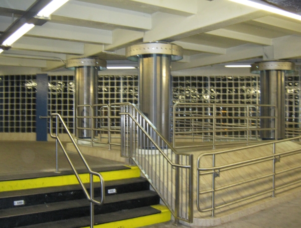
On our second day in Santo Domingo, we went with one of my wife’s colleagues to see if we could ride the subway. My wife’s colleague spoke better Spanish than any of us, so she asked the soldiers guarding the entrance if we could go in. They politely said it was off limits and wouldn’t open until November, so she asked them how we could get to the park we wanted to visit. They explained how to use the guaguas and which route to take, which was a big help and got us off on a good start.

Guaguas are minibuses (sometimes minivans) that operate on fixed routes. The price in June was twenty pesos, about sixty cents US. I never saw one with air conditioning, and in fact the side doors were always open. In addition to the driver they have a cobrador, which literally means “fare collector,” but they also act as conductors and touts. The routes are confusing, so at any bus stop the cobrador will call out the major destinations. People can bring luggage on the guaguas; one time my son and I boarded a bus and came face to face with a chicken sitting on a man’s lap.

The guaguas are operated by independent contractors, and their profits are proportional to the number of fares they collect. Because of this, drivers and cobradores will try to pack as many people into the bus as they possibly can. If there are only a few passengers, the driver will go slow, and the cobrador will jump down at every stop and shout the destinations at everyone nearby. Sometimes they will stop in between official bus stops to try and convince people to ride.

The most common guagua has three or four rows of seats in the back, with two seats on the left and one on the right. When these are full, there are jump seats that fold down in the aisle. This would be crowded enough, but the cobradores insist on squeezing five people into those four seats, no matter how fat, so that they can announce to potential passengers that “hay asientos!” If a passenger in the back seat has to get out, everyone in the jump seats in front has to stand up and move out of the way. There are also various jump seats mounted on the engine well, and then room for standees; if there are too many standees, the cobrador will ride hanging out the side door. Small children are expected to sit on laps whenever seats are scarce.

Because the guaguas can go slow when they’re not full, and spend a lot of time loading and unloading, many people opt for the carros publicos. These are taxis (usually small Japanese sedans) that run on fixed routes. They cost thirty pesos (about ninety cents US), and have no cobradores, but the drivers of these will also try to fit as many people in as possible, to the point of having four or five people across in the back seat and two in the front, sitting on laps whenever possible. The advantage is that they fill up quicker, so they tend to spend less time fishing for passengers, loading and unloading.

The motoconchos have a similar advantage to the carros publicos, with even less room. These are motorcycles (or maybe scooters) that take passengers on the back. I never felt comfortable trying them.

For the first week I saw several minibuses passing by our hotel with doors closed and air conditioning on; they looked so comfortable compared to the guaguas we rode! They occasionally let passengers off at our stop, but never let anyone on. I asked around, but no one could tell me where to get them. Finally I went to the major bus transfer point on the Avenida Duarte, and found the answer. They were medium-distance buses going to and from towns an hour or two away. That’s why they got the air conditioning, and that’s why they couldn’t pick up passengers within the city limits.

In another post, I’ll explain why I think the case of Santo Domingo is relevant for us here in the US.

Dominican Republic, Santo Domingo, Spanish

Spanish News: Santo Domingo Metro Opens Monday

Máximo Gómez station
Máximo Gómez station. Photo by Orad

La Nación Dominicana: El Metro costará RD$105 millones cada mes, arranca el lunes de forma gratuita, hasta el día de reyes.

SANTO DOMINGO, Dominican Republic, December 19.  According to Diandino Peña, the monthly operating cost of the Santo Domingo Metro will come to roughly $3 million US, or $105 million pesos at the current exchange rate.

Mr. Peña, the Director of the Transportation Reform Office (OPRET), also announced that on Monday Metro will begin the long-awaited in-service test of  Rapid Mass Transit Line 1, with full access to passengers at no charge through Epiphany on January 6.  Ten trains will circulate, each with a capacity of  650 passengers, and straphangers will have to wait no more than 5-6 minutes for a train.

Mr. Peña made the announcement alongside Manuel Vásquez, Miguel Ángel Sánchez and Rafael Serrano.  Mr. Vásquez, from Spain, was a consultant on the construction of the Santo Domingo Metro on loan from the Madrid Metro.  Mr. Sánchez will serve as Chief of Operations for the Santo Domingo Metro representing the Spanish side, while Mr. Serrano will fill the same function on the Dominican side.

Mr. Peña explained that once the in-service test with passengers is completed, covering the entire line and all the stations, they will conduct an inspection and evaluation of all of the subsystems and rolling stock in terms of their ability to respond to diverse situations, in the face of a demand that is expected to be higher than originally projected.

Once all the 19 trains are put into service, Mr. Peña said, they will prepare to charge fares by the end of January.  He and his colleagues invited all who are interested in the Metro to visit the sixteen stations on Line 1 during the following hours:

December 22-24, 26-28 and 31; January 2-6 9:00 AM through 7:00 PM
December 25 and January 1 1:00 PM through 7:00 PM
December 29 and 30 7:00 AM through 7:00 PM

On the other side of the operations, Mr. Peña announced that the OPRET will meet with Dominican business owners, including transportation syndicates, to determine who will operate feeder lines to the Metro.  He also assured the audience that the operation of the Metro will not affect electricity consumers nearby, because it is fed by two power lines of 69 and 138 megawatts.

As for the operating cost of the Metro, Mr. Peña explained that at the beginning it was expected to be around three million dollars per month, but eventually it would be lower due to better understanding of the system.

Background, Better Buses, Brazil, Curitiba

Eh Curitiba!

Being a transit geek and spending an inordinate amount of time reading Streetsblog, I’m well aware of the city of Curitiba, Brazil, famed as a pioneer of Bus Rapid Transit. I’ve even translated an article about Curitiba’s plans to build an elevated metro instead of expanding their BRT system.

I was kind of amused, therefore, to hear the name of the city shouted out as I was boarding a crowded #7 train on Tuesday morning. A man boarding behind me shouted, “Eh Curitiba!” and a woman at another door responded “Saudades do brasil!”

It turned out that they knew each other, and were clearly tourists, losing their balance on the subway and taking pictures of each other, but I noticed another couple chuckling and exchanging glances. A few minutes later I heard that couple quietly talking to each other in Portuguese: they too were Brazilian, but didn’t know the others.

I was curious: why had the man shouted out the name of a Brazilian city? What did he think of Curitiba’s BRT, and of the 7 train? I didn’t work up the courage to ask, and in fact I must confess I eavesdropped, although often it’s not hard to eavesdrop on Brazilians. In fact, the larger group heard the couple speaking Portuguese and started up a conversation as the train headed into the tunnel at Hunterspoint Avenue. Here’s what I was able to pick up:

The couple was from Rio de Janeiro and had been living in New York for five years. The other group was from the state of Paraná (of which Curitiba is the capital), but not from Curitiba itself. They were clearly tourists, but based on the code-switching of a boy in the group (“Olha o bridge, pai!”) had probably been living somewhere in the US for a couple of years.

Based on this, my guess is that the man’s invocation of Curitiba was a reference to the “ultra-crush capacities” often mentioned when people question the applicability of the Curitiba model to North American cities. Being from the countryside of Paraná, when he and his friends squeezed their way onto the #7 train the first thing they thought of was being packed on a bus in Curitiba. If the Flushing Line at rush hour is like Curitiba now, and people want to build more BRT, it doesn’t exactly make me hopeful for the future of transit in New York City.

View More